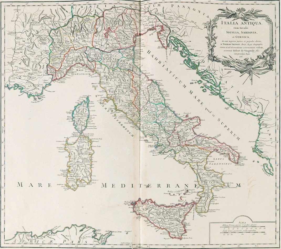

Title: Antique Map On Rag Paper Of Italy By Sanson & DeVaugondy
Shipping: $39.00
Artist: N/A
Period: 18th Century
History: N/A
Origin: Southern Europe > Italy
Condition: Museum Quality
Item Date: 1600 to 1786
Item ID: 5690
This wonderful large vintage map of Italy, can be used as elegant frame wall art. This has been engraved and Printed on handmade antique paper. 18th Century. "Italia Antiqua Cum Insulis Sicilia, Sardinia et Corsica..." by Sanson & DeVaugondy: 19-1/2"T x 26-1/2"W paper size: Paris, 1751, Robert de Vaugondy, Didier, 1723-1786; Robert de Vaugondy, Gilles, 1688-1766; Sanson, Nicolas, 1600-1667. Copper plate engraved map on chain lined paper, having antique hand coloring, decorative title cartouche in upper right corner and scale in lower right. Plate impression 19-1/2" x 22". Condition: Faint toning at perimeter, very good. We are committed to enhancing our customer’s lives by discovering creating, and pointing out only the best art we can find in the world today. We Are Taste-Makers, Art Advisers & Consultants.
Link: http://en.wikipedia.org/wiki/Cartography
Cartography (from Greek, khartes = papyrus (paper) and graphein = to write) is the study and practice of making maps. Combining science, aesthetics, and technique, cartography builds on the premise that reality can be modeled in ways that communicate spatial information effectively.
The earliest known map is a matter of some debate, both because the definition of "map" is not sharp and because some artifacts speculated to be maps might actually be something else. A wall painting, which may depict the ancient Anatolian city of Çatalhöyük (previously known as Catal Huyuk or Çatal Hüyük), has been dated to the late 7th millennium BCE. Other known maps of the ancient world include the Minoan "House of the Admiral" wall painting from c. 1600 BCE, showing a seaside community in an oblique perspective and an engraved map of the holy Babylonian city of Nippur, from the Kassite period (14th – 12th centuries BCE). The oldest surviving world maps are the Babylonian world maps from the 9th century BCE. One shows Babylon on the Euphrates, surrounded by a circular landmass showing Assyria, Urartu and several cities, in turn surrounded by a "bitter river" (Oceanus), with seven islands arranged around it. Another depicts Babylon as being further north from the center of the world.
The ancient Greeks and Romans created maps, beginning at latest with Anaximander in the 6th century BC. In the 2nd century AD, Ptolemy produced his treatise on cartography, Geographia. This contained Ptolemy's world map - the world then known to Western society (Ecumene). As early as the 8th century, Arab scholars were translating the works of the Greek geographers into Arabic.
A map is a visual representation of an area – a symbolic depiction highlighting relationships between elements of that space such as objects, regions, and themes.
Many maps are static two-dimensional, geometrically accurate (or approximately accurate) representations of three-dimensional space.
Cartography or map-making is the study and practice of crafting representations of the Earth upon a flat surface (see History of cartography), and one who makes maps is called a cartographer.